Caravan navigation is a different problem from ordinary car navigation. An underpass that’s no issue for a sedan can be a disaster for a 3.2-meter-tall motorhome. This guide covers both campsite-discovery apps and vehicle-size-aware navigation solutions, with an honest look at real-world conditions in Turkey.
Two Different Needs: Campsite Discovery and Vehicle Navigation
Caravan route planning actually solves two separate problems. The first is answered by campsite discovery apps (Park4Night, iOverlander, Kamplist) — “where will I stay tonight?” The second is answered by vehicle-specific navigation apps (Sygic Truck & Caravan, CoPilot) — “can this vehicle actually fit down this road?” Most experienced caravanners use both types together: one to plan the route and overnight stops, the other to guide the actual daily drive.
Park4Night: The Biggest Database, But With Gaps in Turkey
Park4Night is one of the most widely used caravan overnight-stop apps worldwide, with a huge, constantly updated database built from user-submitted locations, photos, and reviews. But to be honest about Turkey specifically: the Aegean coast is reasonably covered and the Mediterranean region is improving, but inland Black Sea areas, Eastern Anatolia, and Southeastern Anatolia have sparse entries that are often out of date. Anyone traveling in these regions shouldn’t rely on Park4Night alone — cross-checking with alternative sources (local forums, Turkey-specific apps like Kamplist) is recommended.
Kamplist: A Turkey-Specific Alternative
Kamplist is a domestic app focused on campsites in Turkey. You can explore on a map, filter results, save favorite spots, and follow editor-approved listings and new campsite announcements (Kamplist). Domestic platforms like this, which have the potential to fill Park4Night’s data gaps in Turkey, are a useful complementary resource when planning routes through less-documented regions.
iOverlander: Strong for Water and Fuel Points
iOverlander shows detailed listings for campsites, hotels, and restaurants, as well as water refill and fuel points — a feature that’s especially valuable given the tank management and route-planning topics covered in our earlier articles. It’s actively used and community-updated in many countries, including Turkey. Marking water and fuel points ahead of time on long routes is a practical habit for avoiding unpleasant surprises.
CaraMaps: The Offline Advantage
CaraMaps is another app with over 90,000 listed points. Its biggest advantage is that you can download maps in advance and reach campsites, parking areas, and various service points without needing an internet connection — a feature that makes a real difference in Turkey’s rural regions where mobile data coverage can be weak.
Vehicle-Size-Aware Navigation: Sygic and CoPilot
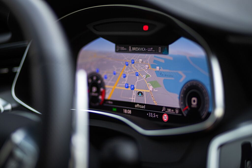
Sygic GPS Truck & Caravan is a navigation app designed for professional drivers and large vehicles. By entering vehicle type, size, weight, and trailer count, the route is calculated according to those parameters — helping you avoid hazards like low bridges or narrow streets before you get there. The app also offers speed limit warnings specific to trucks and caravans, and allows multi-stop route planning with up to 150 waypoints (App Store). CoPilot GPS Navigation offers a similar service; in Turkey, an annual caravan navigation subscription starts at roughly 184.99 TL.
The biggest value of these apps is accounting for height and weight restrictions that standard apps like Google Maps or Yandex Navigation don’t consider. A standard navigation app can happily route you toward a tunnel with a 3-meter height limit or a bridge rated for 7.5 tons — a serious risk especially for owners of larger motorhomes.
A Practical Recommendation: The Layered Approach
Most experienced caravanners don’t rely on a single app; instead they use a layered system: Park4Night + Kamplist for route and overnight-stop planning, iOverlander for water/fuel points, CaraMaps as an offline backup, and Sygic or CoPilot for vehicle-size-aware navigation during the actual drive. This prevents the data gaps or technical limitations of any single app from derailing the trip.
Technical Details to Watch When Planning Routes
When using vehicle-size-aware navigation apps, entering the correct vehicle profile is critical. It’s not just total height — mirror-included width, axle weight, total length if towing, and turning radius all affect the route calculation. Getting this data right from the vehicle registration document or manufacturer spec sheet is a precondition for the app suggesting a genuinely safe route. An incorrectly entered height (for example, forgetting to include a roof-mounted air conditioning unit) can cause the app to route you toward a dangerous underpass.
Narrow, winding roads are common in Turkey’s mountainous regions, particularly the Black Sea coastal road and Eastern Anatolian mountain passes. In these areas, a standard navigation app may route you along what’s technically the “shortest” path but is impractical for a large vehicle. Checking local caravan forums and Facebook groups for current road conditions is a valuable supplement to app data in these situations.
The Importance of Downloading Offline Maps
Mobile data coverage can be unreliable in Turkey’s rural and mountainous regions, so downloading the map for the relevant area before setting out should be an almost mandatory habit. Most apps, including Google Maps, Yandex Navigation, and CaraMaps, offer offline map downloads — but checking how current those maps stay and re-downloading them periodically (every 1-2 months, for example) ensures road changes (newly opened roads, closed bridges) are reflected.
Community Data: Strengths and Limitations
The biggest strength of apps like Park4Night, iOverlander, and Kamplist is user-generated content. A review, photo, and rating left by one caravanner becomes a valuable guide for the next. But this model has a weakness too: data can go stale or simply never form in less-visited regions. Checking the date of reviews before heading to a stop (prioritizing reviews from the last 1-2 years) and, where possible, confirming by phone or a local source guards against relying on outdated or no-longer-valid information.
Fuel and Charging Point Planning
Fuel planning is another valuable feature of dedicated navigation apps. While fuel station density is high on Turkey’s major intercity highways, distances between stations can grow on rural routes. Fuel point markers in iOverlander and similar apps are a planning element that shouldn’t be skipped even with a large fuel tank. For campers using electric or hybrid tow vehicles, the charging station layers in Yandex Navigation and Google Maps are becoming increasingly useful, though it’s worth remembering that charging infrastructure on intercity routes in Turkey is still developing.
Screen and Audio Ergonomics: Using Apps While Driving
Checking a phone screen while driving a large motorhome carries more distraction risk than in a standard car. That makes clear, well-timed voice guidance (with enough distance before a turn) just as important a criterion as screen size. Apps like Sygic and CoPilot allow mounting the phone within the driver’s field of view using vehicle mount kits; some users prefer a separate tablet or dedicated navigation device instead, keeping the phone free for music or communication.
Pre-Trip Checklist
Vehicle profile: Enter height (including roof equipment), width (including mirrors), weight, and length correctly into the vehicle navigation app.
Offline maps: Download the map for your destination region in advance and make sure it’s current.
Overnight stops: Mark at least 3-4 alternative stops along the route in Park4Night, Kamplist, and iOverlander.
Water and fuel points: Check water refill and fuel station distances on long rural stretches.
Review check: Read reviews from the last 1-2 years for any stop you plan to use.
Frequently Asked Questions
Is Google Maps good enough for a caravan? It can work for short in-town routes, but since it doesn’t account for height/weight restrictions, it poses a real risk on long routes with larger vehicles.
Do these apps work without internet? Apps like CaraMaps can work offline with pre-downloaded maps; Park4Night and iOverlander offer some offline features too, but an internet connection is recommended for the most current data.
Which app is the best starting point for Turkey? Kamplist for Turkey-specific campsite data, iOverlander for international routes and water/fuel points, and Sygic Truck & Caravan for vehicle safety form a reasonable starting combination.
Conclusion
The right combination of route-planning and navigation apps significantly reduces one of the biggest risks of caravan travel in Turkey: unexpected and dangerous road conditions. There’s no single perfect app — the best results come from combining campsite discovery, offline backup, and vehicle-size-aware navigation.
Last checked: July 19, 2026.